Whale research, especially tagging, takes a synergy of many elements. The weather has to be favorable. High winds create chop and swells, low winds lead to calm waters, but without wind, fog can also show up under certain temperature differentials. Conditions change quickly, all with a shift in the wind speed and direction. We also need whales to be present in the study area. Whales in “high concentration” (i.e., > 1), whales of the correct species, whales of the correct age (i.e., we can’t tag mom/calves), whales behaving properly (i.e., feeding – tagging whales during mating and social behavior is risky business). We need good small boat approaches that put the tagger close to the tagging candidate. We need a tagger with aim that is true, we need the tag to fly straight in the air, we need the tag to implant high on the whale’s back so that it is exposed when the animal comes to the surface for a breath, we need a whale that will not breach to dislodge the tag or rub against the sea floor or his friends. We need a research ship that can follow the tagged whale for sampling, we need oceanographic instruments to work as they should. We need the tag to communicate with satellites so we can track the whale. We need the tag to come off eventually, we need to locate and scoop the tag out of the ocean. Thinking about all of the things that we need to be successful, it should seem a small miracle when we actually are.
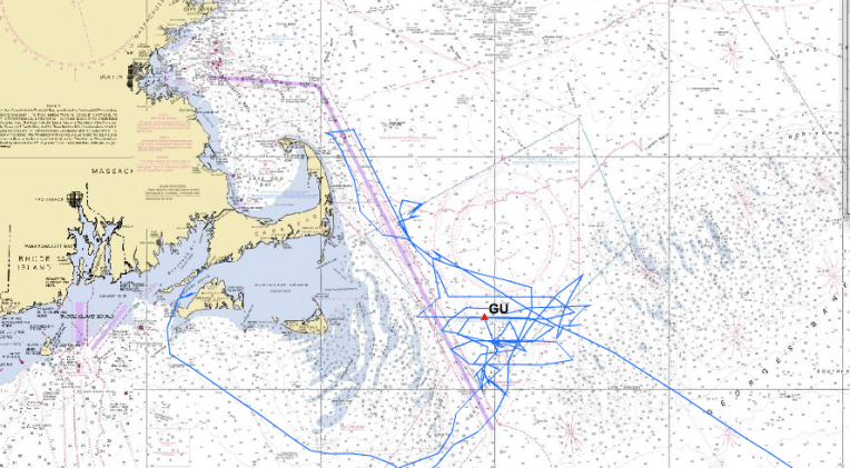 In this long equation of what we need, those of us aboard the Gunter are still stuck on steps 1 and 2…the intersection of good weather and whales being present. We never seem to get one with the other. After driving, bobbing, pitching, and rolling around the Great South Channel for 10 days (see map), it’s safe to say that we’ve surveyed most of the area, and that right whales have not arrived yet (in high abundance). We’re a little early in the season, so everyone hopes that Leg 2 of the trip (May 20-31) will be more active.
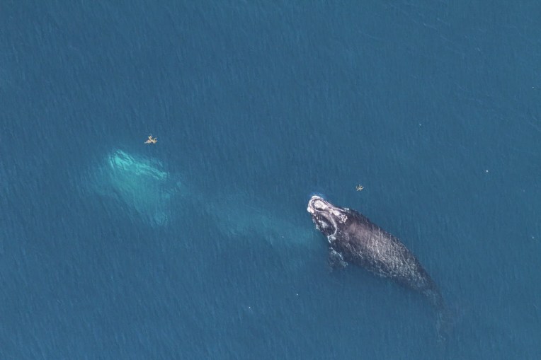
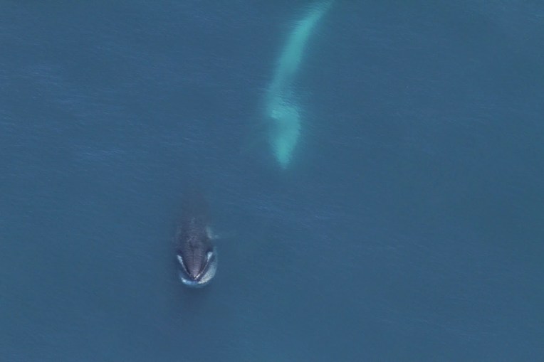
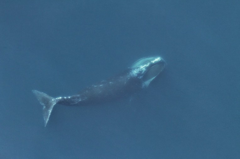
We have seen a handful of marine mammals though. On surveys through the eastern side of the Great South Channel, we were in what I like to call “Fish City”, where piscivores such as fin and humpback whales, white sided and common dolphins, and gray and harbor seals were observed. The western edge of the Great South Channel, mostly shrouded in fog during our time out here, is home to “Plankton Town”, where the planktivores often hang out. At the height of the season, this will be home to a figurative minefield of right and sei whales feeding on copepods.


Plankton Town develops because zooplankton concentrate in high abundance at a density gradient between the fresher waters of the Maine Coastal Current and the saltier Gulf of Maine (see figure below). Unfortunately, Plankton Town also tends to form on/adjacent to the Boston Harbor shipping lanes (the purple lines in the map above). This puts feeding whales at higher risk for vessel strikes, thus the interest in trying to understand how right whales behave while they are feeding.